
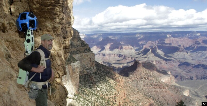
The images were taken this week with Trekker, a panoramic camera device mounted on backpacks worn by a team of Google hikers. The 15 cameras on each Trekker pack capture images every 2.5 seconds, and the pictures are digitally stitched together and posted on the Google Maps site.
The first outing with the 18-kilo Trekker backpack followed the Bright Angel Trail from the canyon rim down to the Colorado River, and back up on the South Kaibab Trail. Google says the panoramic images will be available in a few weeks.
Google officials say they hope to eventually deploy the Trekker to the narrow streets of Venice, ancient ruins and castles, and important wilderness sites around the world, including national forests and even Mount Everest.
Faces of any hikers on the trail will be blurred to ensure privacy. Google has faced criticism, and in some cases, prosecution, for collecting private data as its Street View cameras gathered images in Europe and Australia.
No comments:
Post a Comment